
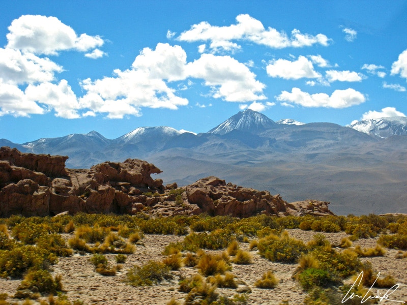
The Atacama Desert in northern Chile… In this mineral world where everything seems so big, so infinite, and so calm. But some rocks are impatient. They wait for the morning surge of the geysers to warm up from the cold night ! Located about 50 miles north of San Pedro de Atacama and 62 miles east of Calama, some 80 geysers offer early risers a daily spectacle as the first rays of the sun hit the geothermal field. The El Tatio Geysers are located on the Altiplano 14,107 feet above sea level in the Antofagasta region near the border between Chile and Bolivia. The Geysers are surrounded by a series of stratovolcanoes, including the Tatio volcano (17,086 feet), Linzor (18,640 feet), and Cerro Linzor (14,370 feet). The name El Tatio comes from the word “el tata” which means “grandfather”. According to local legend, El Tatio, standing about 6 miles south-east of this vast geothermal field, gives its strength to the geysers and also serves as the protector of Atacameños… like any grandfather worthy of the name.

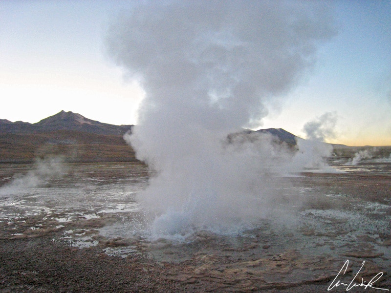
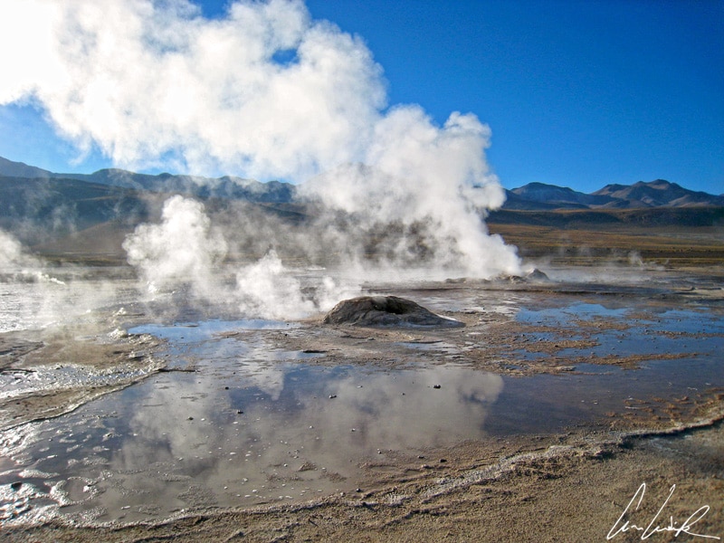
El Tatio, numerous fumaroles, steam vents
With an area covering over 12 sq. miles, El Tatio is the third largest geothermal field in the southern hemisphere and the highest in the world. Numerous fumaroles, steam vents known as soffioni, more than a hundred hot springs (including 80 geysers) and mud pools characterize the field. El Tatio is located between 13,800 and 15,100 feet above sea level. Even if the average height of the geysers is less than three feet, the show is spectacular. At sunrise, when the contrasts of temperature are maximal, the rising steam creates an astonishing display. To see this show you need to make sacrifices, getting up and leaving San Pedro de Atacama in the middle of the night. To reach the geothermal field before sunrise departure is around 4:30 / 5 AM, depending on the season. In the glowing light of dawn some 80 columns of water and white steam rise into the sky. The cold and the high-altitude morning glow transform the hostile landscape into jaw-droppingly magical and mythical scenery. But where does this water, which reaches 185° F on the surface, come from ? The temperature of 185° F is the boiling point of the water at 14,000 feet. Most of the water discharged by the geysers comes from rainfall and snowmelt and enters the ground about 12 miles southeast of El Tatio. The water then travels through aquifers, faults, and fractures in the rock at a speed of about one kilometer per year. The underground journey takes about fifteen years. At a depth between 800 and 1000 meters, the water mixes with magmatic brine, and its temperature rises to 487 ° F. A tiny quantity of water, under great pressure, moves to the northwest beneath El Tatio and is then discharged into the air by geysers and hot springs.

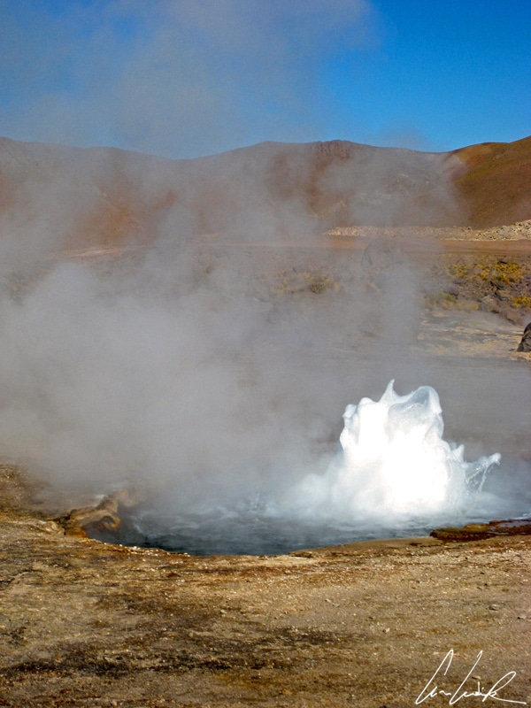
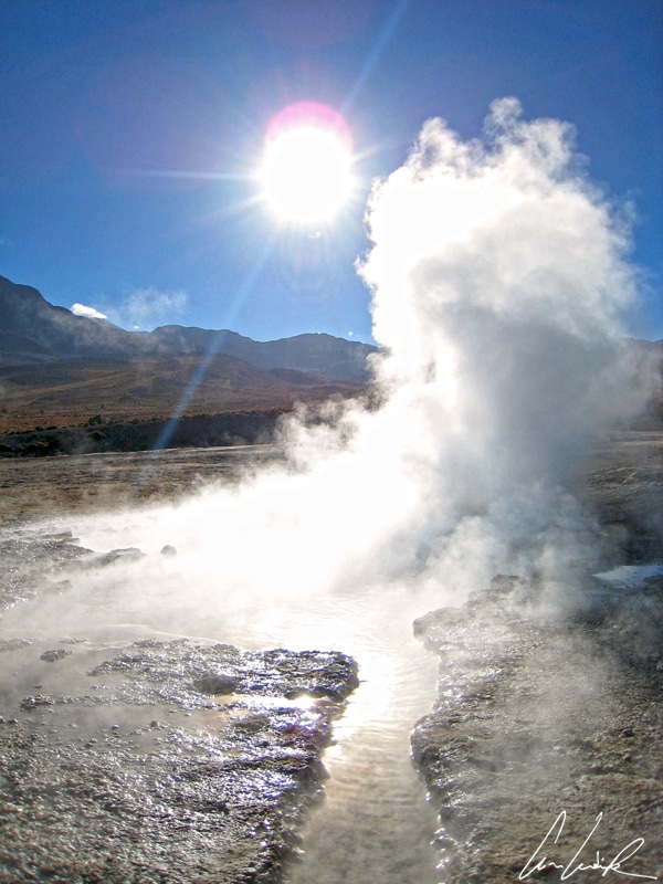
El Tatio, the mirror effects
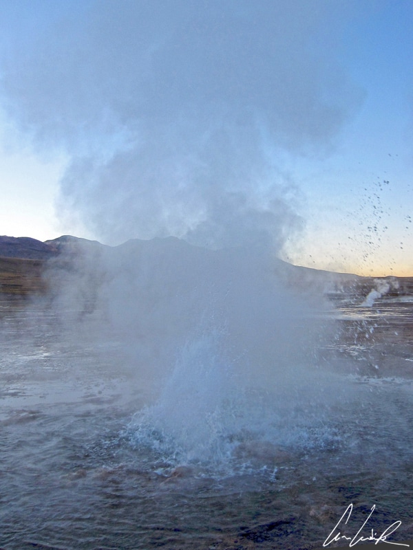
The spectacle begins in soft bluish darkness in the freezing cold of early morning. We are snugly wrapped with layers of warm clothes to defy the cold, but the tip of our nose is nearly frozen by the 14° F air. We wander in this magical landscape among white fumaroles, accompanied by the underground rumbling of water which then suddenly gushes and dissipates into the air. The geothermal field of El Tatio is perforated with geothermal fountains of all sizes and columns of boiling water defy all laws of gravity for a few seconds before plunging into the ground. The soft light of the rising sun transforms the place. The mirror effects and the game of hide and seek between the sun and the steams make the whole place enchanting. At the sound of dozens of kettles whistling around us, we slowly discover the colors of the black and red rocks in the surrounding plain. When the ballet of the geysers reaches its end and the irregular music of the kettles stops, we continue to wander around the pools of colored water. On the terraces of geyserite, the warm waters allow the development of small algae and bacteria which are colored by secreted oxides. Against all odds, there is life here ! After facing arctic cold and being rewarded with Mother Nature’s fabulous spectacle our adventure reaches an end. On the way back, with the temperature close to freezing we can enjoy a bath in warm water from underground. The hot geyser water is cooled by flowing on the ground and collects in pools. Languorous in this boiling sulfur water, you will be surrounded by Germans, Brazilians, Chileans, and French, all cooking “el marmita” and staring at the amazing surroundings… If this “mass tourism bathing experience” is not your cup of tea, there are much quieter and intimate places to swim in a river of hot water. You will be able to paddle along while enjoying the altitude, the snow-capped peaks and the purity of the sky, only disturbed only by the viscaches of the mountains, sometimes called hares of pampas.

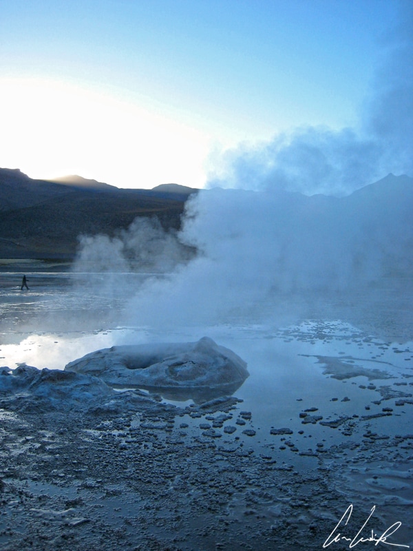
El Tatio, wander around the pools of colored water
In the southeastern part of the El Tatio plateau, we can see the rusty remains of an old geothermal station. Between 1969 and 1974, a geothermal power project was built to supply electricity to the Chuquicamata copper mine and the city of Calama. Seven wells, between about 2,850 and 6,000 feet deep were drilled. For technical reasons, these installations have been entirely abandoned. In July 2008, the company Geotérmica del Norte (majority owned by the Italian energy group Enel) tried once again to drill in the geothermal field to reach hot springs in the El Tatio underground. In 2009, a drilling well blew out and generated an unexplained 200-foot high steam fountain that lasted for several weeks. Here, nature is not easily tamed ! Since that day, the Atacameños use the expression “Tatio Mallku” (“The crying grandfather” in the kunza language) in reference to the tearful sound that Mother Earth (the “Pachamama”) produced in 2008 when man pierced her… Let’s hope that in the future, the “Pachamama” keeps enough strength to dissuade future “drillers of the earth” as it has already done many times.

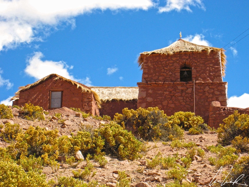
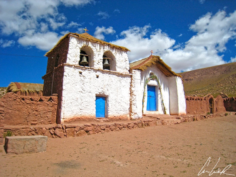
Village of Machuca: the thatched roof church located behind an adobe enclosure
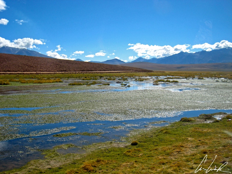
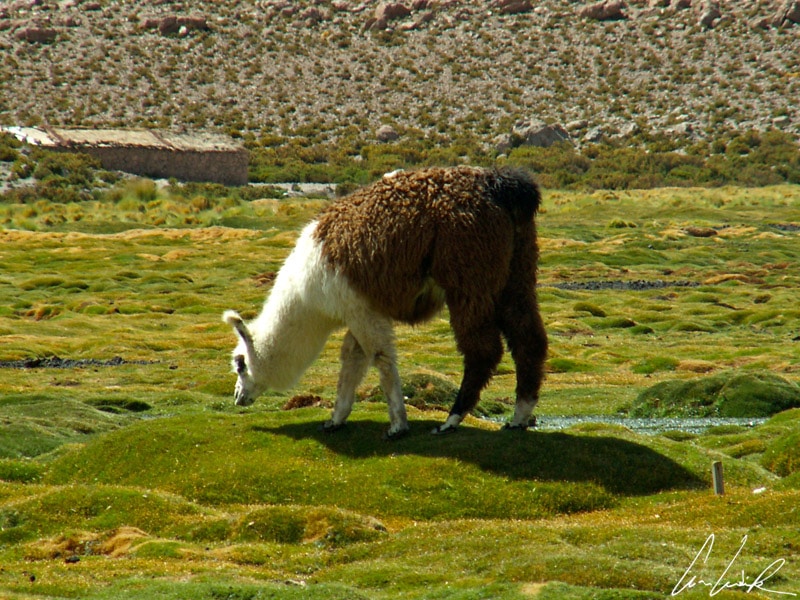
On the way back to El Tatio, we stopped in the unmissable small village of Machuca perched at about 13,800 feet above sea level. A dozen houses stretch in the hollow of a valley, dominated by a lonely church in testimony of past colonization. The thatched roof church located behind an adobe enclosure looks like a dollhouse and seems askew. In this village composed of a single street lined with a few houses, a young lady offers handcrafts: alpaca wool sweaters and colorful Andean cups… A few steps further, an elderly woman with parchment skin sells bouquets of fragrant “rica-rica”, known as Acantholippia in the family of Verbenaceae. Acantholippia grows about 2 feet high, with tiny leaves and produces very fragrant small red or white flowers. The plant is used in traditional medicine for its anti-inflammatory properties against stomach ache, for its anti-oxidant properties, against colds and coughs, and also to improve blood flow. The locals use Acantholippia in a daily tea. The plant is also used in gastronomy. It can be added to the famous “Pisco sour” made of distilled grape alcohol, lemon juice, and sugar. “Rica-rica” created a local flavor known as “Rica-Rica sour” ! Also in Machuca you can enjoy “empadas”, made with cheese and accompanied by the famous llama skewers. Although everyone recognizes the llama as the emblematic animal of the Andes and knows that it is renowned for its wool and qualities as a pack animal, it is less known that llama meat is equally famous. Freshly cooked, llama meat is tender, tasty, and rich in protein (much more so than beef, pork or chicken) while being low in fat… If you prefer to abstain from the local cuisine, you can simply enjoy the fantastic scenery, looking at fields irrigated by small rivers creating fertile valleys… Before us unfolds the immense “bofedales” or high altitude wetland area where llamas and alpacas graze.

The immense “bofedales” or high altitude wetland area where llamas graze.
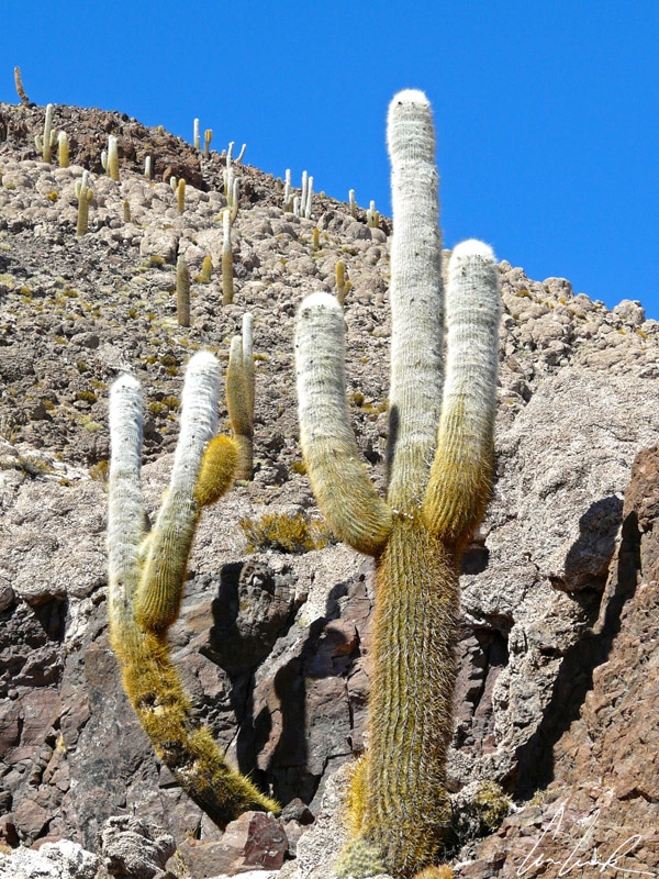
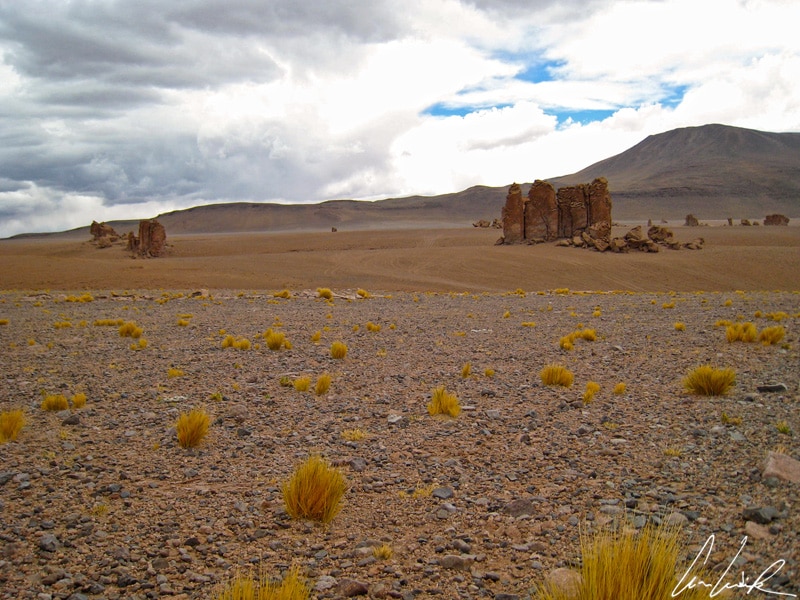
On the way back to San Pedro don’t fall asleep while digesting your llama skewers. The B-245 road offers lovely mountainous landscapes dotted with long silhouettes on the rocky slopes… Ha, ha, I piqued your curiosity ! The Quebrada de Guatin, about 18 miles from San Pedro, features three different types of cacti. The cactus Cardón (Echinopsis atacamensis) whose big colored spines are used as knitting needles is by far the most impressive. The spines can be as long as 12 inches. Many of these cacti are over 100 years old and can reach a height of 30 feet. In the distance, they look like sentinels guarding the mountain. At any moment, we almost expect Indians to pop out from behind these candelabra as trees just like in a good old western ! The tall silhouette of the Cardón resembles the saguaro of the Sonoran Desert. These Cardón cacti were a precious resource for the Atacameño. The wood of the cactus was used as doors for houses and churches and in making furniture. The rose-white flowers have hallucinogenic properties and were used during rituals… The flowers are about 4 inches long and pop up on the side of the plant. Above all do not abuse the Cardón cactus flowers, and keep all your senses alert to admire the herds of vicuña wandering on the Altiplano. The Incas called the fur of this wild mammal, thin and extremely slender, the “wool of the gods”. Softer, rarer and more expensive than alpaca and cashmere, the wool of the vicuña remains even after twelve centuries the very best and the most luxurious of all ! Purists will emphasize that it is not wool but a fiber. The vicuña fiber is thinner: about 12 microns in diameter versus 15 microns for cashmere (hair is about 70 microns !). It also has the amazing feature of having a hollow section that allows it to retain heat. At the time of the Incas, huge hunts were organized with the goal of encircling entire herds. Of all the animals captured, only vicuña were sheared and released. All other animals were slaughtered and their meat consumed. The wool was reserved for the manufacture of ornamental tapestries and the clothing of the imperial family. Today, breeders proceed in a similar way by gathering herds of vicuñas during “chaccu” comparable to those organized in the 15th and 16th centuries. The animals are shorn and released. An adult animal provides only 550 grams of raw wool and only 120 to 150 grams of usable wool. The vicuña can only be shorn every three years because of the slow regrowth of its coat… Take out your calculators… It takes six to eight adult vicuñas to provide the wool necessary for a sweater, and over thirty for a coat, which explains the high price of anything made from vicuña wool !

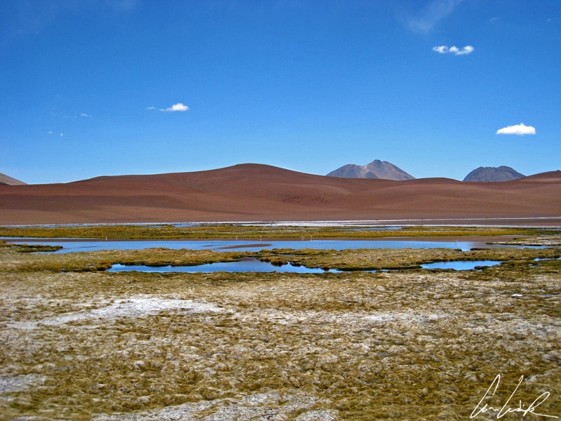
Vegas of Quepiaco
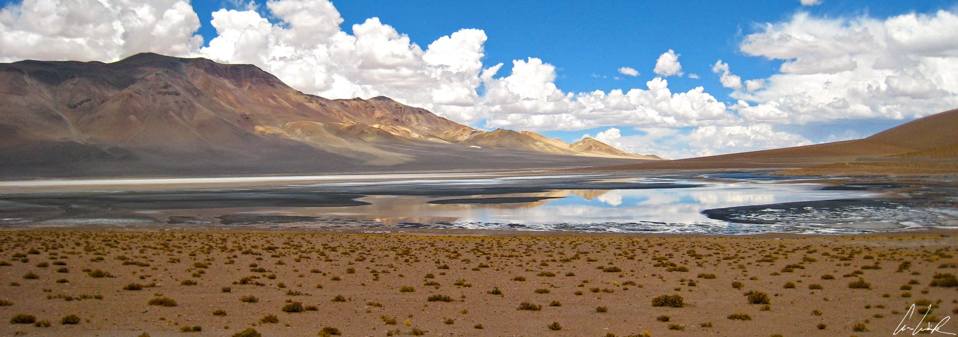
In the midst of the lunar landscape of the Atacama Desert; we sometimes find isolated corners with salt water and wild vegetation, such as the Salar de Aguas Calientes. Aguas Calientes and Salar de Tara are in the Los Flamencos National Reserve about 80 miles east of San Pedro de Atacama. A lonely international paved road connects San Pedro de Atacama and Paso de Jama at the border with Argentina. The road (Ruta 27) goes up into the highlands along the Bolivian border and the shimmering Licancabur volcano (19,423 feet) and flirts with the pristine blue sky at 15,780 feet above sea level. The highest point on the route is kilometer 48 at 15,091 feet offering a panoramic view. Thirty kilometers further, a belvedere faces the Vegas of Quepiaco, small lagoons used as nesting place by a wide variety of birds, and also columns of rock reminiscent of sentinels, known as the “Monjes” (monks), “Guardianes” (guards), the Pacana or Maoi de Tara. These giant volcanic stone figures were carved from volcanic ashes according by the caprices of time and wind… We are at the eastern edge of the Atacama Desert. This region has more abundant rainfall which seasonally feeds the lagoons. When the water of the lagoon is not too brackish, vicuñas and foxes come to drink, leaving their tracks in the salt…


This is such a wonderful and rich experience. I can totally imagine it in my mind. These moments are treasures! And you ate llama? I didn’t know you can eat them!
Visiting El Tatio Geysers and hot springs for sunrise, and driving through the scenic landscapes of the Atacama Desert in Chile is an amazing experience ! Llama is delicious! Its supposedly one of the healthier meats around too, very lean 🙂
Wow how awesome is this!! This place looks stunning and so much to learn!! My husband tried Alpaca, but similar in meat to llama. they were just too cute for me to eat!
The spray forms pools of water on the ground, streaked with silver reflections as they catch the first rays of the sun: it’s a magnificent spectacle ! The locals say that alpaca are generally for food and Llamas are for carrying goods much like a mule. I have been told that Llama tastes like a mild Alpaca but is much chewier 😉
This sounds like an ultimate experience of a lifetime and your pictures are just stunning! Though I had no idea that people eat llama too!
Thank you 🙂 The Geysers of El Tatio in San Pedro de Atacama, Chile, is one of the most amazing sites in the world ! It’s low in fat, high in protein and fiber and showing up on high-end menus as tourists try the meat in dishes like llama carpaccio 😉
What a lovely experience at El Tatio Geysers and around the Atacama desert. I visited San Pedro de Atacama two years ago and loved it. We didn’t have a chance to go to the geysers and it is so wonderful to read and see the pictures from your experience. It looks like we did miss out! I actually enjoyed llama meat and pisco sours with rica-rica. Great region and amazing food!
The charm of the Atacama is not easily defined. It truly is one of the most astonishing places on earth, more akin to visiting another planet. However, much depends on the way you approach it, because central to your experience of this vast desert is the breathtaking quiet, a silence so profound that at the heart of ruckled vermillion ridges you can hear the salt crack in the rocks and flamingos sip on slate-grey lagoons. It’s impossible not to be moved by the Atacama 🙂 🙂
This place must be an unusual experience to explore a different world. I’m awstruck at its beauty, The pics are simply mindblowing.
Lunar landscapes, salt lakes dotted with fluorescent flamingos and geysers spurting clouds of steaming water into the frigid dawn air: this is the Atacama Desert !!
Omg! I’ve been there and loved it! I went swimming in the sulfur pools too! Getting out was a nightmare though. So freezing!
Yes! It is possible to bathe in the hot geyser water in a small pool. By the time, we got to the spring many people were already enjoying the warm waters 😉
WOW, such a mind-blowing destination! Just loving each and every photo especially the colored waters and reflection. This desert does not seem like lifeless, quite different and unique.
Thank you 🙂 There are some places that are just made for photography, and the Atacama Desert is certainly one of those places !
Wow, this place is like nowhere I have ever been! You’ve so rightly described the landscape as lunar. The pictures are awfully scenic though. I wonder, with hardly any vegetation around, what do the locals do for subsistence?
Thank you 🙂 This arid landscape dotted with volcanoes and lagoons is a true photographer’s paradise. Locals have learned how to adapt, to manage water, to create their villages.The Atacama Desert crop agriculture is contracted around small oases.
Your pictures are incredible and I really appreciate all the details here. I haven’t spent much time in a geothermal field, but they definitely weren’t this large. I haven’t been to Chile yet but will definitely add this to my list when I do!
The geysers themselves are impressive and probably a must see if your are nearby. With its vast diversity of landscapes, hip cities and plethora of wine regions, Chile undoubtedly crowns the list of top travel destinations 😉
Your photos are so gorgeous! I always find geysers (and other incredible naturally occurring wonders) to be so amazing, and you captured them beautifully. I would love to try and get to the geysers really early in the morning or later at night when the crowds are gone and go for a little dip!
Unlike Yellowstone National Park, you can get up close to the geysers. Now is this safe? Probably not. But I enjoyed being able to involve most of my senses in the experience. You can see, touch, and smell the steam and heat coming off the geysers…
Wow, such an interesting experience – I’ve not heard of El Tatio but it certainly interests me. Llama meat, did not know that you can eat that – not sure if I could do it though.
The early rise to make it to El Tatio for sunrise is well worth it 😉 Llama is an extremely tender, succulent and versatile meat. Lean, low in cholesterol, yet high in protein and iron. Only thing that beats it is emu. I’ve had emu; I’ll take the Llama.
People eat ilama? Never knew that but such stunning photos! I love geysers and this does it so much justice. Thanks for sharing this beautiful experience with us.
Although llama is mostly known for its fur, the meat of the llama is also used for regional meals ! Sunrise and steam all around are definitely worth visiting 😉 To be fair, when you’re in such a spectacular setting as El Tatio it doesn’t matter where you start; you’re just completely caught up in where you are.
Geysers are such interesting and beautiful phenomenon to observe, the landscapes are honestly amazing. I’d love to see it in real!
Landscape and the fantastic geysers at this altitude combined with the light show of the sunrise are definitely worth it to get up early 😉 The Atacama desert should definitely be on your bucket list. If it’s not, it soon will be…
Wow I had no idea that such a place even exists and truely a magical place. Although I’m not really an early riset but to see such a natural spectacle I would wake up early as well.. llamas are such cute animals and I had no idea if people eat them, oh the very thought just made me sad 🙁 love your storytelling 🙂
We had some time to walk around the geysers and soak in this other worldly scene. It was cool seeing giant bursts of water shooting into the air, bubbles gurgling just below the surface of some of the lagoons, and little clouds of steam rising from open pockets in the earth – the latter was a nice way to warm up our frozen fingers 😉 People have been eating llamas and alpacas for centuries. Alpacas have been a domestic livestock species for 6,000 years for meat and fiber. The Incas didn’t have cattle; they had llamas and alpacas !
This looks so peaceful and beautiful! The sulfur pools, all the green <3333
The terrain is like being on another planet, just like you would expect in the Atacama Desert, and with the eery atmosphere of the geysers adding to the landscape it’s a very unique place !
Wow what an amazing place! Thanks for introducing me to it! And your photos are simply stunning
Thank you so much 🙂 Surrounded by emanations of water and steam, we really enjoyed the beauty of the El Tatio Geysers: a unique spectacle in the world !