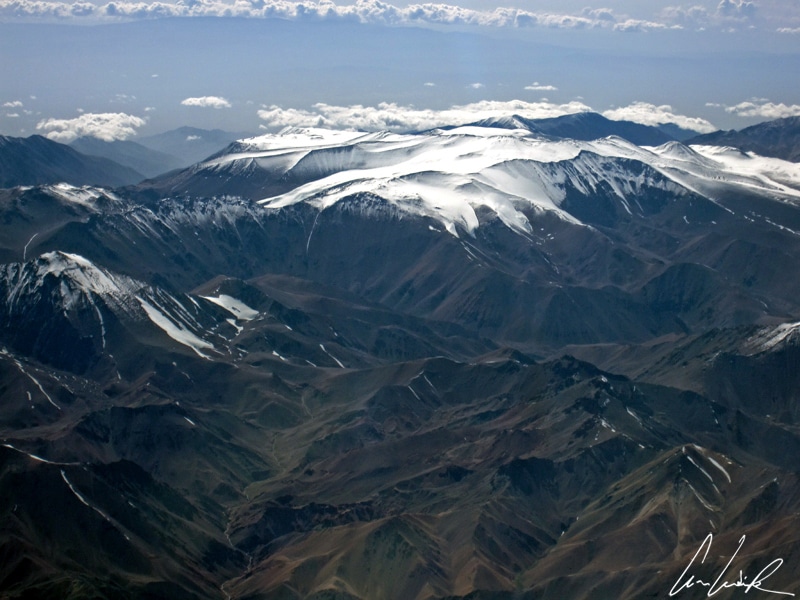
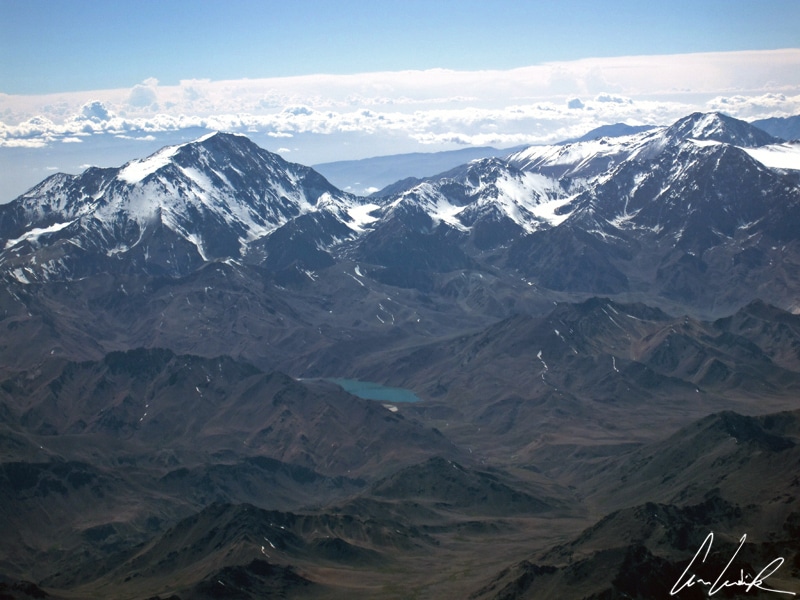
Lunar landscapes, snow-topped volcanoes, vast salt lakes, bubbling geysers: the landscape of the Atacama is breathtaking. The Atacama Desert lies in the northernmost part of Chile. The region is sometimes called “El Norte Grande” and extends from the Peruvian border to the mouth of Rio Loa on the Pacific. The Pacific Ocean lies to the west and the Andes Mountains to the east. It is the first administrative Region of Chile. Lying two hours by air from the capital Santiago, the Atacama is the driest desert in the world and covers 41,000 square miles of almost absolute drought… The average rainfall is 0.6 inches per year. Seen from the air it is yellow-ocher and crossed by the furrows of dry river beds and rectilinear dirt tracks. The vision would seem almost infinite if our gaze did not meet the snowy peaks of the Andean volcanoes in the east, culminating some 20,000 feet above sea level. The land has enormous mineral resources. Rich deposits of copper, sodium nitrate, silver, lithium have supported, and also taken the lives, of hundreds of thousands of Chileans who came to seek work and fortune in this hostile region… Welcome to the mining town of Calama, the “copper city” located at the gates of the dusty Atacama. The first signs welcome tourists… Valle de la Luna, Valle de la Muerte, Los Flamencos National Reserve etc., defining the attractions of this unique region.

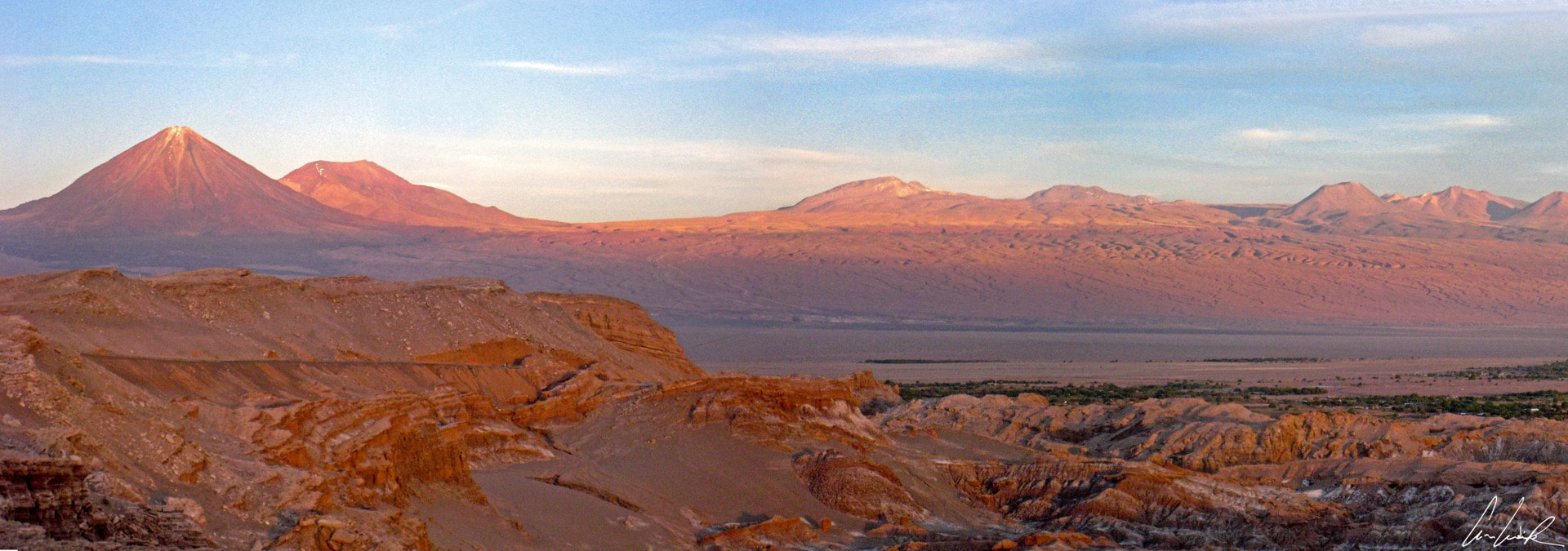
The snowy peaks of the Andean volcanoes
The town of Calama, in the central region of the Atacama Desert, saw a mining boom at the end of the 19th century with the completion of the rail line Ferrocarril de Antofagasta a Bolivia. Just outside Calama is one of the largest open-pit copper mines, producing 36% of the world’s production. 1,500 tons of copper are excavated every day ! The Chuquicamata mine is owned and operated by Codelco (Corporación Nacional del Cobre de Chile), a State-owned company. It is gigantic… The mine was opened in 1882. Do you have any idea of its size ? The open-pit is the world’s largest and is about 3 miles long, 2 miles wide, and 2,750 feet deep. It could hold a six-story building without any problem ! It is the second deepest open-pit in the world after the Bingham Canyon Mine in Utah. A parade of trucks, looking very small in the distance, takes the rock containing green copper oxide from the bottom to the top of the mine… These gigantic trucks, 23 feet high and 26 feet long of which the wheels alone are 12 feet in diameter, take 30 minutes to go down into the mine and more than an hour to come back up… They consume one gallon of fuel per minute ! Hum, hum, let’s not talk about the environmental impact and embarrass the number one employer in the city of Calama, but there is a dark side to this economic force. Although the company’s slogan is “Orgullo de todos” (pride in all), the economic benefits of its activities are better known than the adverse effects. Copper mining is not without environmental impact. Sulfur, arsenic, and heavy metals such as lead, nickel, and chromium are released into the atmosphere. The pollution spreads throughout the northern region of the country. The mine contaminates everything: air, water, and finally the human body… The choice between economic growth and protection of the environment remains one a significant question for economists. The Chilean economy is heavily dependent on the copper industry. You can make up your own mind, but know that the Chuquicamata mine has enough deposits for another 60 years of excavation…

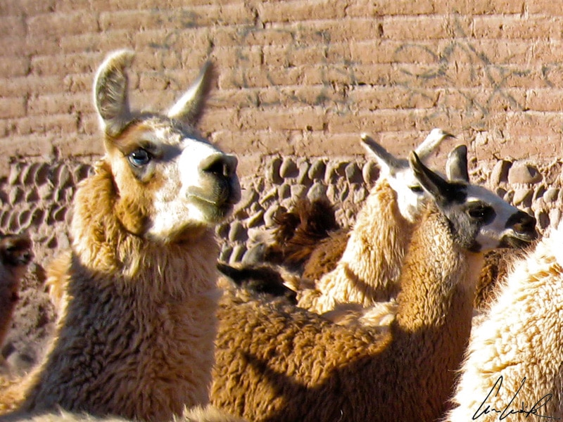
Lamas in the streets of San Pedro de Atacama
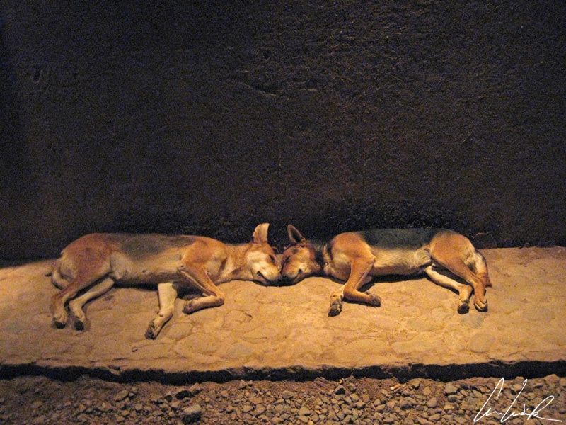
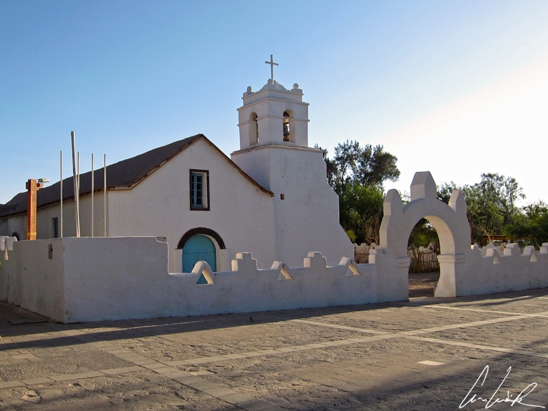
Is it the altitude or the monotonous and silent vastness of the surroundings that gives us the feeling of being « Minuscule » (Tiny) like ants lost in the Valley ? After driving for more than an hour in this dramatic and colorful desert, the landscape suddenly exploded as we arrived at the small oasis of San Pedro de Atacama. A few trees, some greenery, in the background the magnificent sight of the Licancabur volcano, and some straw-covered adobe houses. At 7,900 feet above sea level, the village of San Pedro is the perfect base for exploring the region. San Pedro de Atacama was founded in 1450 and has had only a handful of inhabitants since. Even today, there are only about 5,000 inhabitants, the result of an influx of “afuerinos” (people coming from outside) along with the tourist boom of the 1990s. San Pedro’s terra-cotta streets are given over to tourism. Hotels, restaurants, bars, tour operators, gift shops offering Andean specialties (including herbal tea containing coca leaves, which is very useful for altitude sickness) have multiplied over the past ten years… The town has become a popular tourist destination offering various activities. Lying on the main paved road to Argentina, it is located 60 miles southeast of Calama. Under a blazing sun, tourists walk the dusty streets past the “touts” of travel agencies (which grow like mushrooms) while many dogs take a nap (Ma qué calor !). However, this village has not yet lost its charm. Slowing strolling along the main street, called “Caracoles” (“snails” in Spanish), we pass beautiful terra cotta houses from which the Chilean flags and “Wiphala” (a rectangular flag with seven colors used by the Andean ethnic groups) float side by side. We wander, moving whichever way takes our fancy, toward a nice shady place with a whitewashed church built of cactus and carob tree. At a corner of an alley, we ran into lamas, which are not uncommon. They greet you with a haughty but curious eye… We would be tempted to caress their soft-looking thick wool, but thinking of poor captain Haddock in “Prisoners of the Sun” in the Adventures of Tintin by Belgian cartoonist Hergé, “When lama angry, señor, always he do this…” And yes, it’s not a myth, the lama actually spits when annoyed. At the slightest annoyance, the lama spits like an atomizer. But when irate, he shoots out a greenish spray. Watch out !

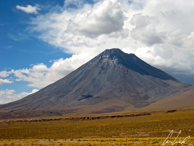
The Licancabur volcano
The village of San Pedro is surrounded by volcanoes, the nearest being the majestic Licancabur (or Llicancahur) on the border between Bolivia and Chile. The Licancabur is sacred to the “Lickan-Antay”, the inhabitants of the territory in Kunza language. The evocative symmetrical cone of this volcano is almost 19,685 feet high with a 1,300 feet wide crater containing the Lake Licancabur, one of the highest lakes in the world. In all the area around San Pedro de Atacama, Licancabur can be used as a compass or lighthouse guiding the footsteps of enthusiastic desert travelers ! A local legend tells that even long-time residents can get lost among the few alleys of the village when the Licancabur is hidden by clouds… At 19,409 feet it is far from being the highest peak in the area and not part of the Chilean Pantheon of volcanos over 20,000 feet high. This dormant volcano does not titillate the crowds. And yet… the Licancabur is much more than a “banal” volcano. Inca ruins were found on its slopes, showing that it represented a place of importance according to local beliefs. Licancabur means “mountain of the people” in the Kunza language spoken by the Atacameños people. The Atacameños worshiped the mountain, considered it divine and believed it brought misfortune. Today, the Licancabur still plays a leading role in rituals dedicated to the Goddess “Pachamama”, which aim to thank Mother Earth with offerings. It is a small step from sacred to popular, and the Licancabur, is now immortalized on t-shirts, keychains, prints, photos. It has another importance as well. The Atacama Desert is a harsh environment with high solar radiation, below freezing temperatures, and the lowest precipitation rate on Earth. Licancabur Lake and its surroundings present a microclimate. Scientists have developed studies in the Licancabur region to test what life on Mars may be like. They have discovered cyanobacterial-like organisms able to survive in conditions similar to the surface of the planet Mars. Can we find the key to survival on Mars here ? A big step for humanity! San Pedro and its surroundings is the perfect spot to turn our eyes to the stars… Because of the advantageous geographical location and the extreme dryness, the Milky Way is bright and clear. At night, you bathe among sparkling stars, not by the hundreds but by billions. In such atmosphere environment, worthy of « Interstellar » one feels both “Alone (s) on Mars” and very “Minuscules” (tiny)…

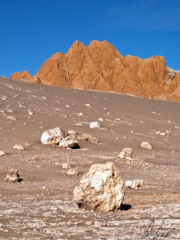
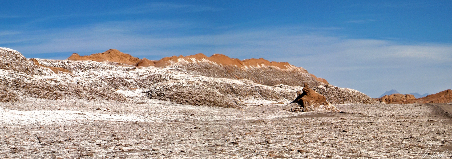
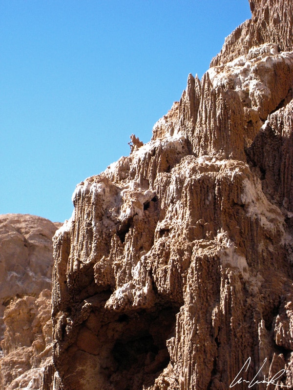
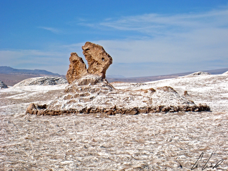
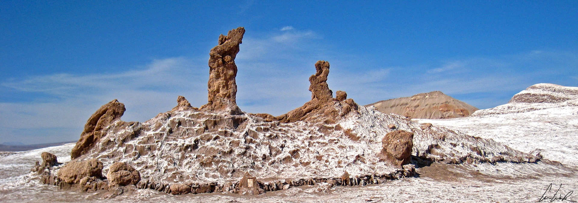
The Moon Valley: the salt that seems sprinkled over the entire landscape suggests a thin film of snow…
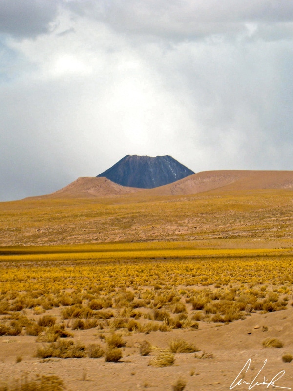
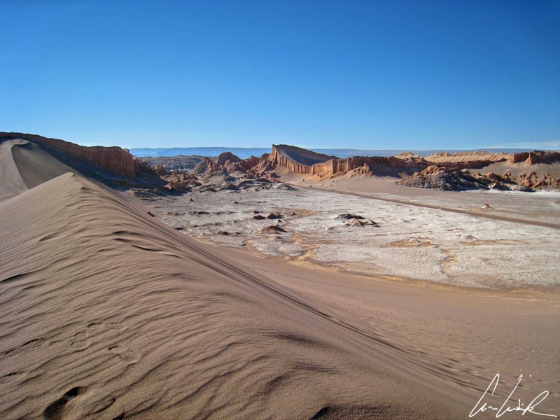
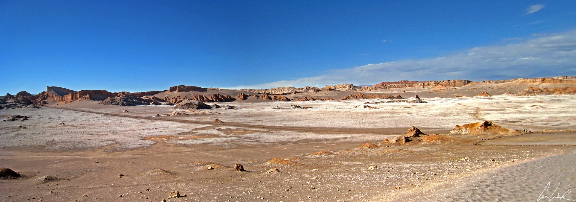
Change of scenery, we leave Mars, the Red Planet, behind and head to the Moon Valley (Valle de la Luna) about 8 miles west of San Pedro. Deep gorges or “Quebradas” cut into the immense Atacama Desert. Some valleys have evocative names such as Moon Valley, Valley of the Dinosaurs (so named because of its mountains similar to the backs of diplodocus) or, more disturbing, Death Valley… La Cordillera de la Sal (salt mountain range) which borders on the Salar of Atacama southwest of San Pedro is home to Moon Valley and Death Valley. The latter is named after a translation error. Originally, the name was the Valley of Mart (Mars) which became “Muerte” probably because of its aridity and salinity, which make any form of life impossible… a big dune is the main attraction. From its top one can glide down on a sandboard. The surreal desert landscape is jaw-dropping. Moon Valley was declared a nature sanctuary in 1982 and is now part of the Los Flamencos National Reserve. This moonlike landscape, devoid of fauna (except Liolaemus, a species of lizard), flora, water, and even noise (the silence that reigns is disturbing) has been carved for millennia by water and wind. The landscape has an impressive range of colors and texture. The area includes a variety of canyons, sharp ridges, deep ravines, gray and ocher dunes and dark caverns that give it a surrealistic appearance somewhat similar to the surface of the moon. We are once again alone and “tiny” in this vast desert. The deep blue sky contrasts with the ocher and orange hues of the cliffs. The salt that seems sprinkled over the entire landscape suggests a thin film of snow lying gently on the arid soil.

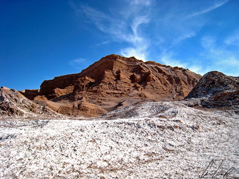
The Moon Valley: El Anfiteatro
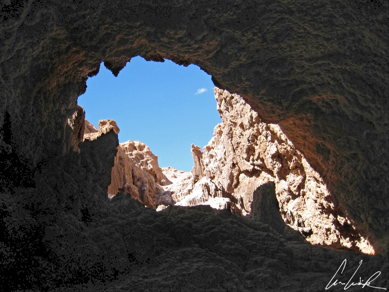
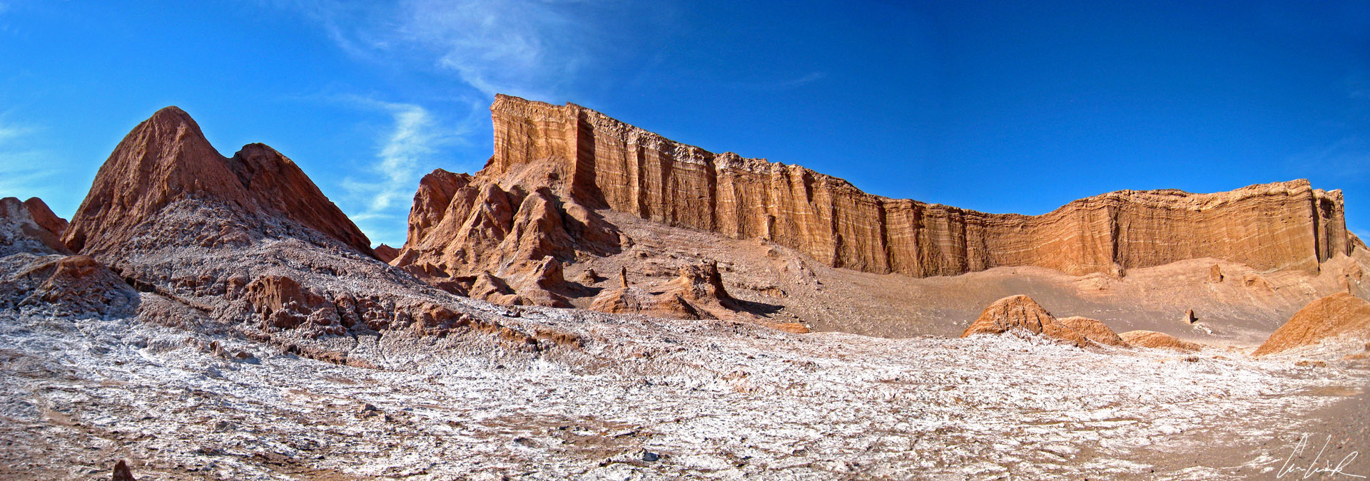
If you have the soul of an explorer and are not claustrophobic, you may enjoy “Las cuevas de sal” (the salt caverns). The hike takes you on a beautiful adventure through canyons and salt caves: a bit of climbing, a few passages in almost complete darkness and salt crystals that sparkle in the sun… Nestled in the cracks, sand sometimes partially coats the rock giving it a softer look. After venturing through “Las cuevas de sal”, we return to the main road and continue our adventure to our next destination, Duna Mayor, a majestic dune with untouched and smooth slopes (it is forbidden to climb them !). Following the path that bypasses the dune, we climb on the top of a hill from which we have a sublime view of the entire valley with its abstract curves. We particularly admire El Anfiteatro, a reddish and orange cliff with almost vertical walls ! Finally, the adventure would be incomplete (perhaps not too much after all) without a final stop at Las Tres Marias, a natural rock in the middle of the valley evoking, with some imagination, Christ surrounded by his three Marys… By now, it is time to watch the magic show of sunset over the valley… The view looks like a dream as the sun slid down and the dunes and the rock formations turn red and other colors… The surreal landscape offers amazing picture opportunities, and, once again, I take another picture of the famous Licancabur before sipping a well-deserved glass of Pisco ! “What, but you don’t already have this shot of Licancabur ? Well, I don’t know, but I like it with the sunset…” Our adventure reaches an end; it is time to go back to San Pedro with a roll of images in our eyes and sand in our pockets !


OK I would have never thought this place would be so cool. Wow, very interesting. Something more to research.
I had never imagined that a desert could have so many different faces as the Atacama desert in Chile 😉 Geysers, altiplano lakes, salt flats, hot springs, salt lagoons…
I had no clue that this place existed! Loving the contrast between the mountains and the desert area of the place. The alpacas are just an added bonus. Beautiful pictures of the place.
Thank you 🙂 The Atacama Desert is fascinating, exciting and really interesting… Should be on your travel bucket list 😉
“Welcome to Mars’ seems appropriate while reading your post! This is very detailed and informative. I’ve never been to Chile. I wanted to touch the lama though. I didn’t know that line or myth! Good thing you mentioned that or else I would’ve witnessed an atomizer-like spit. lol
Thanks. Ha, ha, Llamas and alpacas are sweet animals but won’t hesitate to spit at you ! Fortunately, I’ve just seen it 🙂 It’s not a myth, the lama actually spits when annoyed. So, watch out !
This unique beauty looks like in those pictures in Mars! You are so lucky to visit this fantastic place.
The incredible landscape of Chile’s Atacama Desert is like no place on earth. With its jagged, rust-colored ravines, vast, rocky, white salt pan and volcano-topped horizons, you would be forgiven for drawing comparisons with places beyond our atmosphere !
I don’t think I have ever seen quite an interesting looking desert. I have yet to travel to South America and visit Peru and Chile. They are both very beautiful and rich cultured countries.
Peru is beautiful and still one of the top countries to visit on my bucket list ! And there are many good reasons to travel to Chile 🙂 The landscape is unique, the culture and people are just fantastic.
Places like that with such magical views do makes us feel tiny indeed! The salt caverns sound like an amazing place to visit, such a unique experience.Lucky you! I need to get away and travel asap!
The Atacama Desert is home to some of the most incredible landscapes on the planet ! I’m sure you will love your journey there 😉
Wow! Fantastic photos — they belong in a magazine spread, actually, because you’ve got the eye for photography for sure! I haven’t ever been to Chile, but I could easily see me adding it to my travel bucket list! And I love llamas! Thanks for sharing the beauty of such a beautiful place!
Thank you ! Visiting the Valley of the Moon is a must. Both during the day and at night, a unique and magical site unlike everything known ! You just take a seat in the front row, watching the theatre of mother nature unfold . Should be on your travel bucket list 😉
Your photos are fantastic! I never knew of this place and it really does look like Mars! I have been hearing so much about Chile and the beautiful landscapes in this region.
Thanks 🙂 Chile has a wealth of beautiful landscapes beyond the iconic regions of Patagonia and Atacama !
You included such beautiful pictures! I have visited Death Valley NP in California, which also looks like being on Mars. I’d love to see what unique and stunning landscapes will await me in the Atacama Desert.
Thank you 😉 The Atacama Desert is undoubtedly one of the most spectacular places I have ever visited from a photographic point of view ! The wilderness of the Atacama Desert with its glittering salt flats, desert moonscapes and live geysers is just amazing !
Oh my goodness I need to go here. DO you know if people hike Licancabur, I just did Kilimanjaro which is about the same height. Sounds like such an interesting and beautiful landscape. I would love to check out those salt caves.
The ascent to the crater is rather a challenging altitude hike and not serious mountaineering. There are 2 ways to get to the base of the Volcano. One option is to start from San Pedro de Atacama in Chile. The other alternative is to add on the ascent during a tour in the south Lipez / Uyuni Salar region in Bolivia.
I feel in love with mountains this year so this post makes my heart melt. Haven’t quite got the courage to scale one though…not yet.
Many visitors come to see the spectacular landscape of the Andean Highlands. Snow-covered mountains more than 6000 m high contrasting with blue lakes, mountains showing all shades of red and brown due to their volcanic origin. The Atacama Desert is home to some incredible landscapes !!
The photos are amazing! The film of salt does look like snow and offers an interesting contrast to the ochre landscape. Loved reading the part about the llamas and the legends about Licancabur. The copper mines present an interesting dialogue: how to balance environmental conservation with economic demands.
Thanks 🙂 Travel to northern Chile is unlike visiting any other part of the country’s variegated landscape ! Copper has always played an important role in sustaining and improving human society.The metal is used for a wide variety of applications, going from statues, pipelines and roofing to high-technological applications like semi-conductors and the copper chip… So, it is difficult to imagine human society without copper ! On the other hand, however, the extraction of copper involves large quantities of water, the application of heavy chemicals, the discharge of heavy metals, huge amounts of energy and vast amounts of waste. This… Read more »
Amazing! Halfway through your post, and I’m already craving to visit this unusually beautiful Chile’s Atacama Desert. Moon Valley looks mesmerizing and I can’t wait to hike those salt caverns. Thanks for sharing such wonderful post.
Thank you 🙂 We’ve really experienced authenticity and extreme beauty during these Atacama Desert journey. Atacama in Chile leaves you speechless 😉 Mountains and volcanoes, lakes and salt flats, red stones and white valleys compose a region which seems taken from another planet.
Wow! Fabulous place and fantastic photos! This place definitely looks like Mars and you are very lucky to have visited. I’m glad I discovered it through you!
Chile has a wealth of beautiful landscapes ! Well, here’s your chance to visit that surreal landscape of Atacama in your lifetime;-)
What a stunning place. You’re right, it is otherworldly! I think you are brave going through the caverns, although the sparkling salt sounds magical. Did you get spat on by a llama or did you manage to avoid it?
As soon as we climbed in the Valley of the Moon it became pretty evident how the valley gets its name 🙂 If you have ever dreamed of exploring the moon… a trip to Moon Valley in Chile is a much shorter flight ! Ha, ha, Llamas are sweet animals but won’t hesitate to spit at you… Fortunately, I’ve just seen it 😉
Wow I hadn’t heard about this desert before. Your pictures are breathtaking love every shot you shared here.
Thank you 🙂 As a landscape photographer, the Atacama desert in Chile has always been a dream trip for me 😉
Wow, so beautiful landscape. I would love to see it myself on site to dwell into such natural ambience but probably it will never happen.
Seeing the sharp pictures already make me feel like I am there.
Thank you for sharing Celine.
Thank you so much Hoe 🙂 When one considers the desert, what usually comes to mind are sand dunes and scorching temperatures… In fact, Chile’s Atacama Desert is a place where the landscape varies from colorful lagoons in the Altiplanic highlands to moon-like rock and, if you are lucky, you might even get to see snow 😉