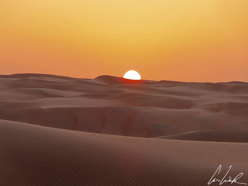
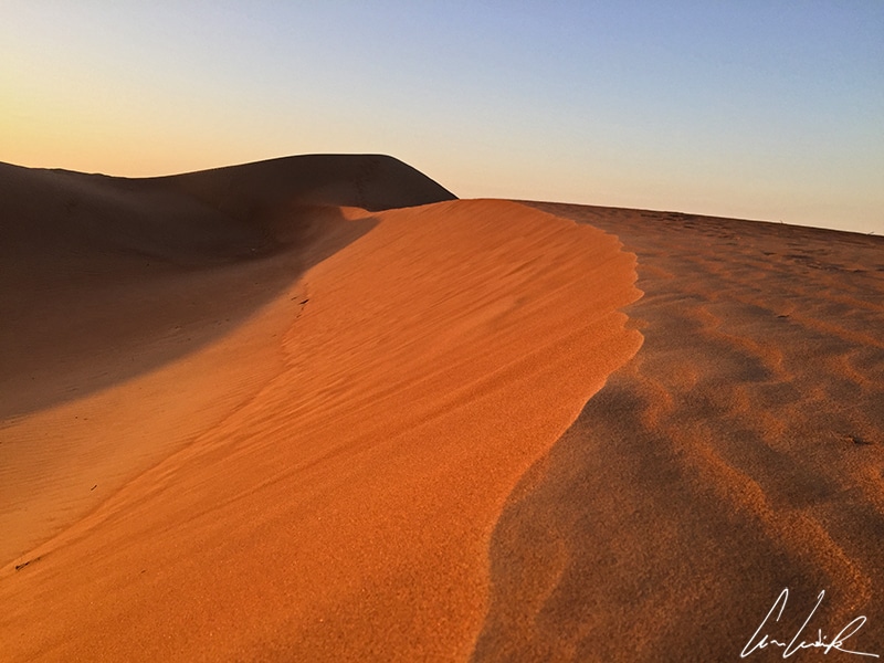
- 1 The sand deserts: an ocean of motionless waves or almost…
- 2 Stone deserts: a desert expanse of rock formation
- 3 The salt deserts: add a grain of salt to your travel…
- 3.1 The Salar de Uyuni: the largest salt desert in the world
- 3.2 Lake Eyre: a giant salt lake in the heart of Australia
- 3.3 The Etosha Pan: a huge dry lake in the Etosha National Park
- 3.4 The Great Salt Lake: the largest saltwater lake in North America
- 3.5 The Salar of Atacama: the largest salt lake in Chile
- 4 Find more articles on the beauty of the mineral world of our planet !
From the Sahara of the « Little Prince » to the depths of the Great Arctic, from Chile to California, from Jordan to Namibia, from Australiato Bolivia, the desert is found in all four corners of the globe. It gains ground almost everywhere, mainly because of global warming. Today, nearly a third of the surface of our blue planet, about 19 million mi2 or the equivalent of the Asian continent, is covered with sand, stone, salt, or ice desert depending on the continent and latitude.
« I have always loved the desert. One sits down on a desert sand dune, sees nothing, and hears nothing. Yet through the silence something throbs, and gleams… »
(Antoine de Saint-Exupéry)
In the collective unconscious, the desert gives us the image of a burning expanse. Permanently exposed to a blazing sun and covered with thick layers of sand, vegetation survives only with the greatest difficulty. This image is a bit reductive as the diversity of deserts is infinite: burning (Libyan Desert) or icy (Antarctica), extraordinary in their colors (Namib or White Sands), displaying stones sculpted by the wind (Wadi Rum), deserts show their differences marvelously ! But what is a desert then ? The word desert is derived from the Latin « desertum », which designates a vast, abandoned, lonely place… The scarcity of rainfall characterizes desert ecosystems. Among the hyper-arid deserts or absolute deserts (less than 2 inches of precipitation per year), we find the Sahara and the Atacama Desert. The morning dews often constitute the only surface water resource for biodiversity. The desert is home to various plants and animals despite its barren appearance. The plants are primarily fatty or succulent, and the animals are insects, reptiles, rodents, and some nocturnal birds.
« To speak of the desert, would it not be, first of all, to be silent, like it is, and to pay it tribute not with our vain chatter but with our silence ? »
(Théodore Monod)
Fascination and a feeling of isolation, silence, and plenitude: an excursion into the desert is a memorable experience, unique and unforgettable. Beyond its geological characteristics, each desert opens the doors to its own culture and way of life… We invite you to discover the multiple facets of the desert through a selection of our favorite places on four continents: sandy immensities, rocky landscapes, vast stony expanses, plateaus, or large salt lakes. Are you ready for a desert crossing ?
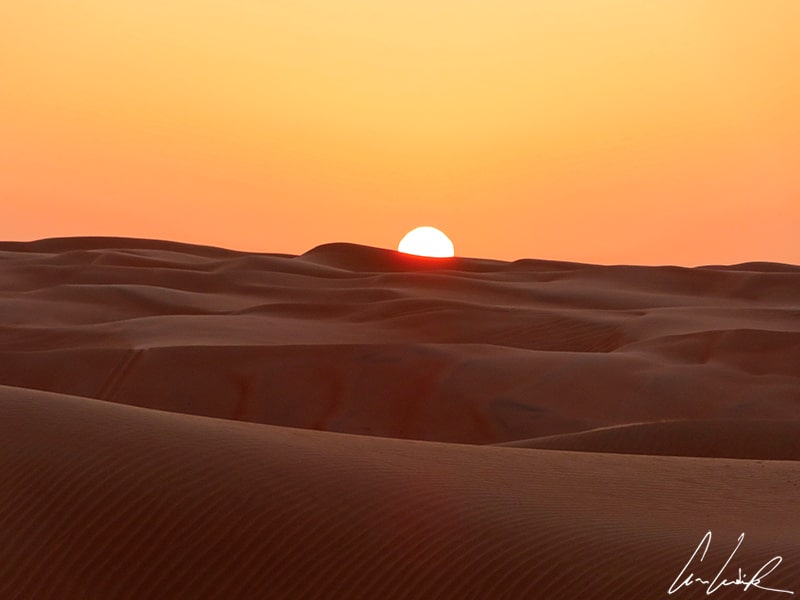
In the early hours of the day, the desert of Wahiba Sands is a dazzling feast of changing colors. under an orange sky, the dunes reveal a palette of orange-gold shades that vary in the sunlight.
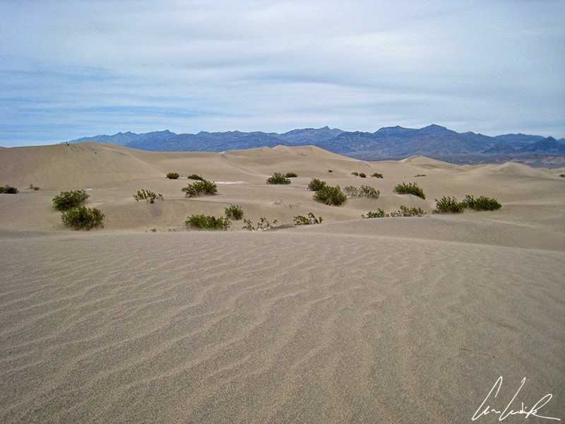
The sand deserts: an ocean of motionless waves or almost…
The sand deserts are vertiginous dunes that change with the wind, ridges that go on forever, and stunning colors that vary in the sunlight. Here, the wind wrinkles the dunes like waves swelling across the sand, and the sun does the same on the skin of the Bedouins. In the wind, the dunes sometimes sing. A few dozen dunes in the world are known to be singing dunes. This phenomenon is due to the shape of the grains of sand, remarkably homogeneous, which would allow them to roll down the slopes in perfect synchronization. The sound can reach 110 decibels, as loud as the music in a concert hall !
The Arabian Desert: in the footsteps of Lawrence of Arabia
The second-largest sandy desert in the world after the Sahara (3,552 million mi2) is the Arabian Desert (900,000 mi2). It extends through nine countries: Saudi Arabia, Bahrain, Iraq, Jordan, Kuwait, Qatar, the United Arab Emirates, the Sultanate of Oman, and Yemen. This ocean of sand surrounded by mountains lies between Africa and Asia. It served as the setting for some scenes of the famous epic British film based on the life of English lieutenant T.E Lawrence…
Desert of Wahiba Sands
The Wahiba sands, also known as Sharqiya Sands, are located in the Sultanate of Oman, where they form an isolated ocean of sand bordering the east coast and covering about 4,800 mi2. The towering piles of sand vary in color between ochre and red. The wind pushes these dunes to heights of up to 820 feet, with steep jebels or slopes. The Omani Desert is distinguished by its southern location along the Arabian Sea. In this vast expanse of sand, temperatures range from 14 °F to 140 °F depending on the season. At nightfall, the tremendous starry sky and the almost mystical silence that settles in provide a feeling of serenity like no other. And the sunrises and sunsets are certainly among the most beautiful on the planet !
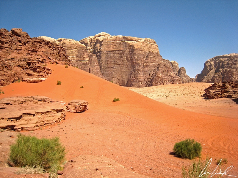
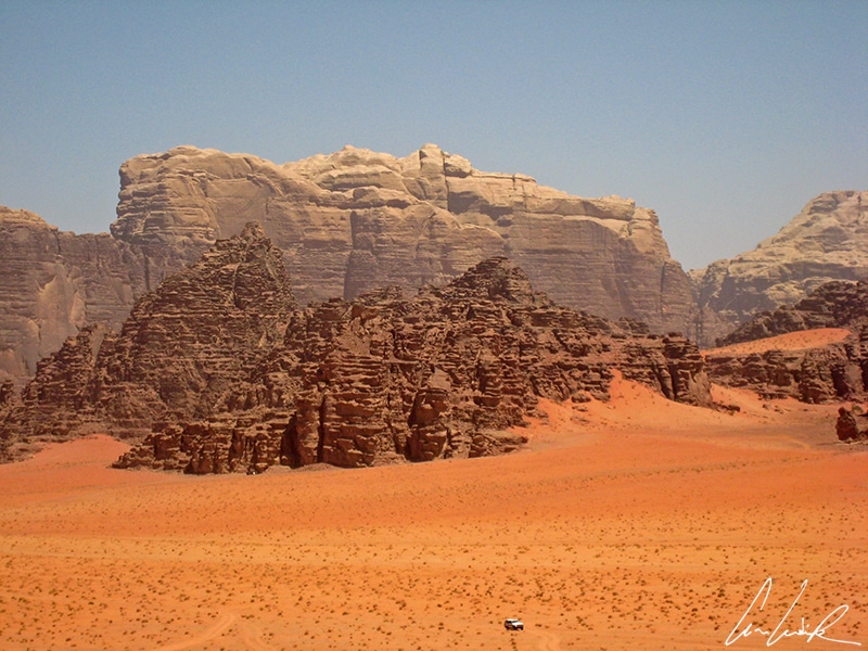
Desert of Wadi Rum
Located in southern Jordan, the Wadi Rum Desert, also known as the Valley of the Moon, is the territory of the Bedouin tribe of Zalabiah. UNESCO listed this desert treasure as a World Heritage Site in 2011. Even today, more than a century after his journey through Wadi Rum, Lawrence of Arabia, whose real name was Thomas Edward Lawrence, feeds the imagination of the place. Your visit will inevitably include Lawrence’s spring, the base camp of the film crew, and Lawrence’s house, the site of some of the most famous scenes of the film « Lawrence of Arabia ». After walking in the footsteps of Lawrence or Rey (a Star Wars heroine), you will be able to fully appreciate the red dunes, the labyrinth of cliffs sculpted by the elements, the stone arches, the narrow canyons, and even the numerous petroglyphs. The Sandstone Mountains, already red in nature, seem to burst into flame at dusk. This magical show continues in the evening around a campfire where we drink sage tea (the Bedouin whiskey, it seems) to the sound of the rabab.
The Kalahari desert: le territoryof the Bushmen (or San people)
Land of the San people (Bushmen), the Kalahari Desert or Kgalagadi, is a vast semi-arid desert in Southern Africa. It covers much of Botswana, southeastern Namibia, and northwestern South Africa – an area of 350,000 mi2. It also has its own cult movie: « The gods must be crazy ». You surely remember the scene where a glass Coca-Cola bottle is thrown out of an airplane by a pilot and falls to the ground unbroken in the Kalahari Desert! The Bushmen are fascinated by the bottle and assume it to be a gift from their gods. They find many uses for it, including crushing their food, working their skins, and making music until the bottle becomes an object of covetousness and causes unforeseen conflict within the tribe.
Kalahari Desert
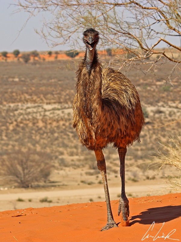
The name Kalahari is derived from the Tswana word Kgala meaning the « Great thirst » or « Waterless place ». Although it has a desert climate, the Kalahari is not a desert: it is a vast sandy plain with rainfall and dense vegetation in places but without water on the surface or in the ground. Any rainfall drains immediately into the deep sands, leaving no moisture on the ground. The low amounts of rainfall allow many mammals, birds including emus, reptiles and amphibians, plants and insects, to thrive. But the king of the Kalahari is undoubtedly the lion, which is, here, bigger, more powerful, and more majestic than anywhere else !
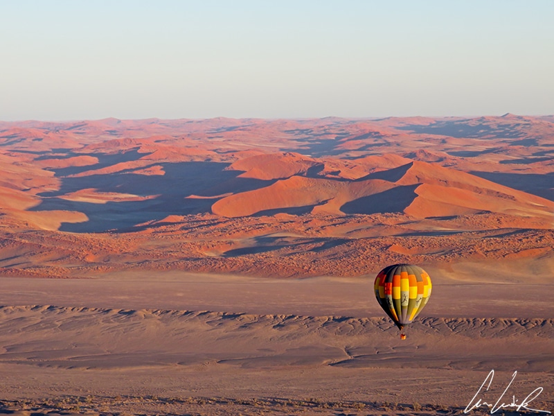
The ancestral Namib Desert: the oldest desert on the planet Earth
The Namib Desert is located in southwestern Namibia. The name Namib is of Khoekhoegowab origin and means « vast place ». It stretches as far as the eye can see along the Atlantic Coast for more than 1,200 miles, varying in width from 30 to 100 miles. UNESCO listed the Namib Desert as a World heritage site in 2013. The Namib Desert is the oldest desert in Southern Africa. Scientists estimate its age as 80 million years…
« The desert was the infinite within the reach of men. »
(Le sang du temps by Maxime Chattam)
Namib Desert
The Namib Desert covers an area of 31,250 mi2. Its dunes are among the tallest and most spectacular in the world. Some reach a height of 980 feet with a palette of color ranging from pink to bright orange. These vertiginous dunes change according to the wind. The ridges spin on into infinity in a fairyland of colors varying throughout the day. Finally, the Namib Desert is one of the driest regions in the world, only the Atacama Desert in northern Chile challenges it. Precipitation is rare and unpredictable, making life or survival very difficult. A cold-water current, the Benguela, along the coast prevents rain clouds from forming. Hence almost absolute aridity…
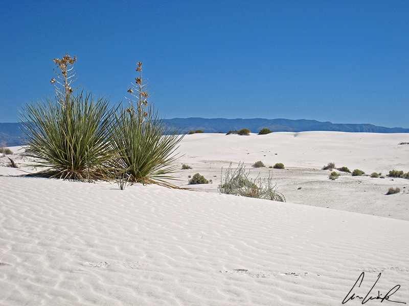
White Sands: the beauty of white dunes
Nested in the heart of Tularosa Basin in the State of New Mexico in the United States, White Sands National Park is the largest gypsum dune field of this kind in the world. The 275 mi2 of snow-white dunes, dotted with green yuccas, contrast with the blue sky. Unlike dunes made of quartz-based sand crystals, the gypsum does not convert the sun’s energy into heat. You can walk barefoot even on the hottest summer days… But beware of sunburn ! The national park includes five different trails, including the Alkali Flat Trail, a 5-mile loop hike, where you are alone enjoying the silence and solitude in the middle of the dune field. These dunes are constantly changing in shape under the effect of the wind: they grow, rise, and then lower but always progress inexorably. There are four forms of dunes: dome dunes, barchan dunes (crescent-shaped), transverse dunes, and parabolic dunes.
Desert of the snow-white dunes
Stone deserts: a desert expanse of rock formation
The stone desert is the most widespread type of desert landscape: it consists of large gravel and rocks rounded by wind erosion. Very little vegetation survives…
« God created the desert, then in a rage he threw stones at it. »
(Arabic Proverb)
The Great Bassin Desert: an immense desert in North America
Located in the western United States, the Great Basin Desert covers an area of about 200,000 mi2, including a large part of Nevadaextending into western Utah and a small portion of southern Idaho, eastern California, and southern Oregon. The Great Basin Desert is one of four deserts in the United States. The others are the Mojave, Sonoran, and Chihuahua Deserts. The Great Basin Desert is classified as a cold desert due to its northern location and higher elevations ranging from 4,000 to 9,800 feet above sea level. The Great Basin Desert also includes the north part of the Mojave Desert (43,750 mi2). Its mountainous landscapes are interspersed with extensive rocky plains, including four of the most famous national parks in the western United States: Death Valley, Grand Canyon, Zion, and Joshua Tree. Death Valley in the northern Mojave Desert is the lowest elevation in the United States and one of the hottest places on Earth. It includes dunes, the famous Zabriskie Point, and the Devil’s Golf course where tiny salt crystals form an inhospitable landscape.
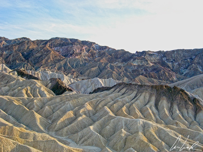
Great Basin Desert – Zabriskie Point – Death Valley National Park
Also part of the Great Basin and located in California‘s Sierra Nevada Desert, Mono Lake offers mesmerizing limestone formationsapproximately 13,000 years old. The columns of limestone rising above the surface of Mono Lake are referred to as tufas (pronounced « toofah »). These towers resemble strange twisted silhouettes rising from the waters. Mono Lake is three times saltier than the ocean and much more alkaline. Writer Mark Twain called it the « Dead Sea of the West ».
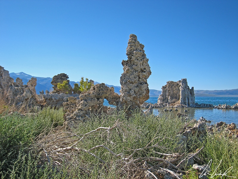
Great Basin Desert – Mono Lake
The Pinnacles Desert: an army of stones in the desert
The Pinnacles Desert is located in southwestern Australia about 125 miles north of Perth. It is dotted with thousands of strange-looking weathered limestone pillars that look like natural menhirs. According to geologists, these limestone concretions, standing up to 16 feet high above the yellow sand, date back 30,000 years. Scientists still dispute the formation of these stone penitents. The most commonly accepted theory is that they are an accumulation of marine seashells. Thousands of shells constitute the astonishing raw material of these rocks. Over centuries they have been sculpted little by little by erosion, giving each one a distinct shape. Each unique pinnacle reveals a new aspect of its personality every moment of the day. To better appreciate the richness of the place, it is necessary to return at different times of day…
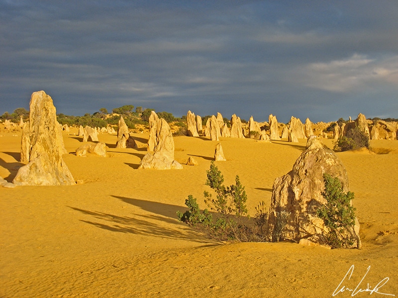
Pinnacles Desert
For the indigenous people, the Nyungar is sacred. According to Aboriginal legend, it was reserved for women to give birth. One day some young men walked through this sacred place, transgressing the prohibition. The gods punished them by burying them alive in the desert. In death, the young men asked forgiveness from the gods and brandished their weapons through the sand, which were then transformed into limestone blocks.
The Great Victoria Desert: the largest desert in Australia
The Great Victoria Desert is the largest desert in Australia, covering an area of 163,115 mi2, or 5% of the country. It is over 430 miles wide from the Eastern Goldfields region of Western Australia to the Gawler Ranges in South Australia. In 1875, the British explorer Ernest Giles named the area after Queen Victoria, the reigning monarch. The Great Victoria Desert consists mainly of stony and sandy plains with many species of shrubs and other plants. It consists of small ochre-colored dunes measuring from 16 to 65 feet high and salt lakes. It is one of the best places to see the Thorny Devil (Moloch horridus), a lizard species endemic to the Australian Desert. The Great Victoria Desert sustains hundreds of species of geckos, skinks, monitor lizards, and snakes.
Great Victoria Desert
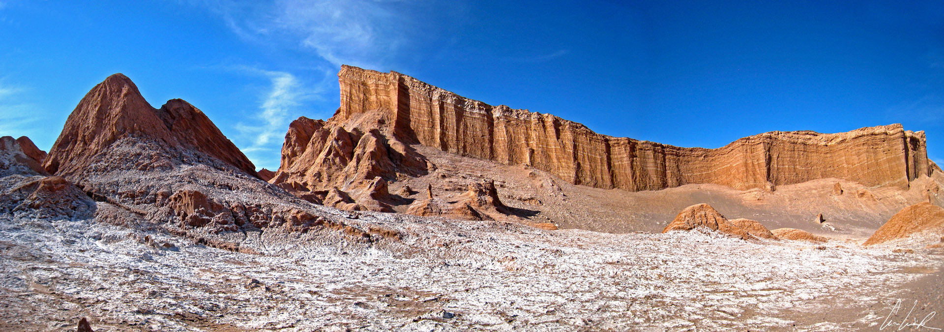
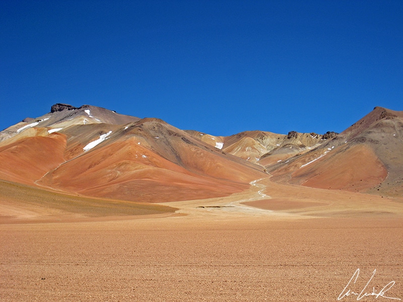
The Atacama Desert: the driest desert in the world
The Atacama Desert in northern Chile is nestled between the Pacific coast and the Andes Mountains. It is a 1,000-mile strip of land from Arica in the north to La Serena in the south. The Atacama covers 41,000 mi2. It is considered one of the driest regions on Earth. Average annual rainfall is 0.6 inches per year. The Atacama Desert reveals astonishing landscapes of barren rocky plateau, salt flats, sand, and active volcanoes. Some areas are considered « absolute deserts », others are more welcoming.
Atacama Desert
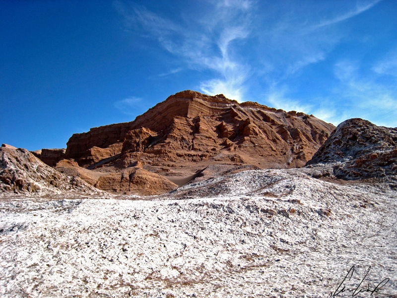
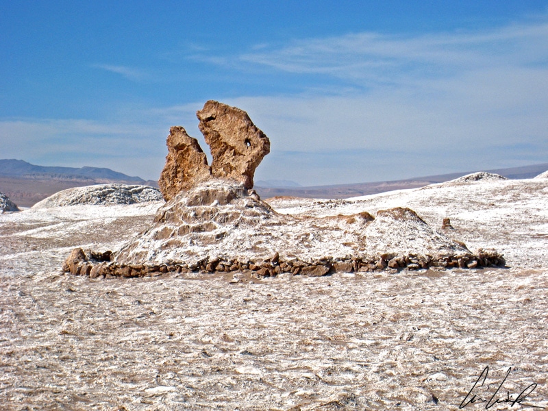
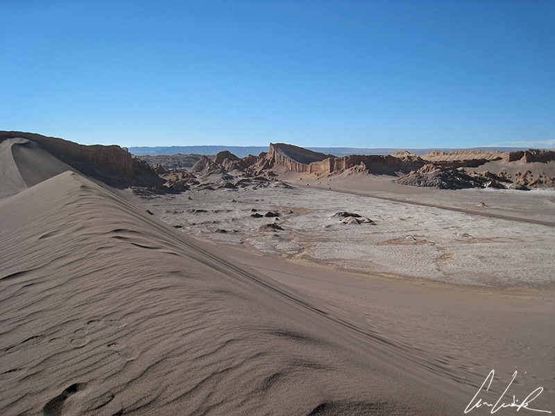
Bluish lagoons, geysers, yellowish vegetation, immense rocky expanses, lands cracked by heat, volcanoes rising up to 20,000 feet above sea level. The Atacama Desert contains a great variety of landscapes. The Valle de la Luna (Valley of the Moon), perched at 7,875 feet above sea level, is 8 miles west of San Pedro de Atacama in north Chile in the Cordillera de la Sal. A moonlike landscape awaits the visitor: dunes chiseled by wind and extraordinary rock formations. The area includes a variety of canyons, sharp ridges, and rivers of salt that stretch as far as the eye can see. The abundance of minerals gives the rocks an impressive range of colors.
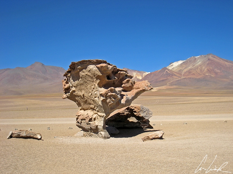
The Siloli Desert: a tribute to Salvador Dalí
Lying nearly 16,500 feet above sea level in the heart of the Sur Lípez Province in Bolivia, the Siloli Desert enchants travelers with its surrealist decor that seems to have come straight out of Salvador Dalí’s imagination! Enjoy the bewitching silence of this desert with magnificent colors from shades of red to brown and stunning natural sculptures produced by the strong winds of the region. In the heart of the Siloli Desert stands the Arbol de Piedra, an extraordinary isolated rock formation shaped like a stone tree and about 16 feet high.
Siloli Desert
The salt deserts: add a grain of salt to your travel…
They are called « salars » in South America or « pans » in Africa. Salt deserts are lakes that have evaporated, leaving only the salty sediments (chlorides, sulfates, nitrates, borates.) They are frequent in arid environments where water evaporates quickly. This intense evaporation concentrates all the minerals coming from the ground. The salt forms a thick crust as thick as several meters in places.
The Salar de Uyuni: the largest salt desert in the world
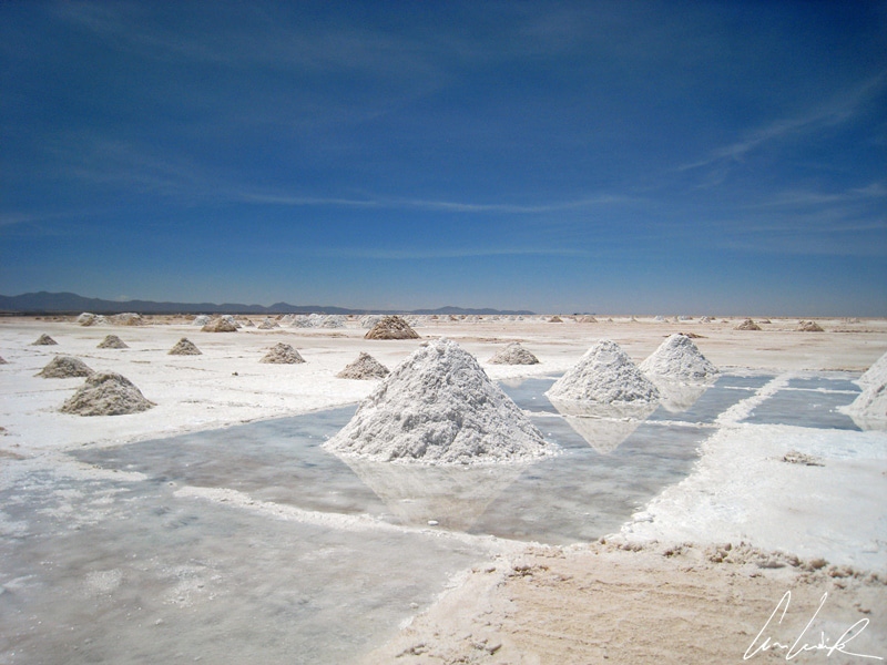
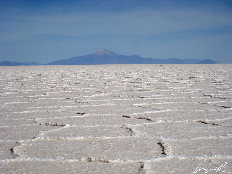
The Salar de Uyuni, also called Salar de Tunupa (in the Aymara tradition), is the largest salt flat in the world, covering 4,086 mi2. Perched near the crest of the Andes at 11,995 feet above sea level, it nestles in the heart of the Bolivian highlands in the midst of thousand-year-old volcanoes. It was formed ten thousand years ago, after Lago Minchin, a giant prehistoric lake, evaporated. Now a desert of salt covers the entire area. The salt crust is up to 460 feet and consists of eleven layers of salt. The Salar de Uyuni comprises 10 billion tons of salt, of which more than 25,000 tons are extracted annually. The lake is also rich in minerals, boron, and other highly sought-after elements, such as lithium. There is undoubtedly a bit of this vast expanse of salt in your laptop or your smartphone… the Salar de Uyuni holds a third of the world’s known lithium resources !
Desert of the Salar de Uyuni
Salt formations are always fascinating because they are a manifestation of order and regular geometry within nature itself. They appear as quasi-hexagons and structure the surface of salt lakes to create a kind of spontaneous « Land Art » better than any artist could have done.
Desert of the Salar de Uyuni
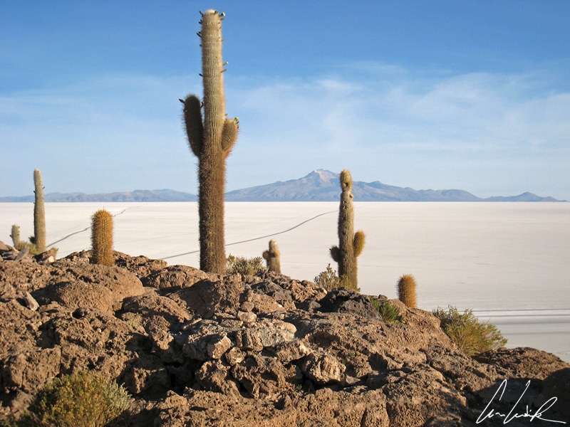
In the middle of the Salar de Uyuni lies Isla Incahuasi, whose name means Island of the house of the Inca in the Quechua language. It is also nicknamed the « Isla de Los Pescadores » (the island of the fish) and is a hilly and rocky limestone outcropping. There are even remains of corals and shells, a reminder that the flat used to be part of a gigantic lake. The isla Incahuasi has a total area of 61 acres, covered with giant cacti (Trichocereus pasacana). They are hundreds of years old and grow at a rate of one centimeter (0.4 inches) per year. Some of them exceed 32 feet in height !
Lake Eyre: a giant salt lake in the heart of Australia
Occupying an area of more than 3,668 mi2, Lake Eyre, officially known as Kati Thanda to the local aboriginal populations, seems to emerge like a mirage in the middle of the Australian Desert. It is located 435 miles north of Adelaide. The lake was named after the first European explorer in the area, Edward John Eyre in 1840. At approximately 49 feet below sea level it is the lowest point in Australia. The average rainfall is between 3.9 and 5.9 inches annually… On rare occasions, the lake fills completely. The shoreline lies 30 feet below sea level when full. Most of the time, we see only an endless salt crust as far as the eye can see: a vast monotonous and white plateau under an infinite blue sky! The lake offers vast flat surfaces as hard as concrete. In 1964, Donald Campbell, with his Bluebird-Proteus CN7, set a new speed record of 403.10 mph…
Desert of the lake Eyre
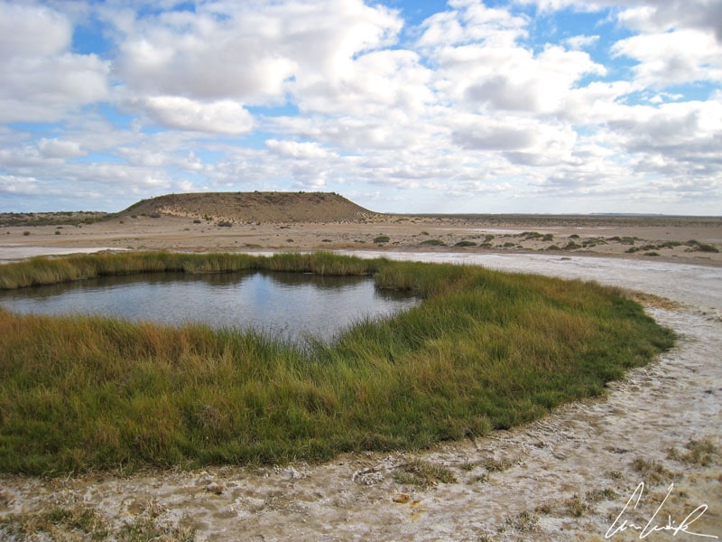
The Australian Great Artesian basin contains some of the last artesian springs where water is forced to the surface at the top of a small mound: Mound Springs. The Great Artesian Basin covers 23% of Australia and is one of the largest groundwater basins in the world. The name, Mound Springs, refers to the distinctive mound that builds up around some springs. The output of salts and minerals and wind-blown sands and clays of the surrounding plains have created these dome-shaped mounds. They are the main attraction in this white and saline immensity – small ponds about 7 feet in diameter where water bubbles up ringed by lush vegetation. A truly surreal landscape !
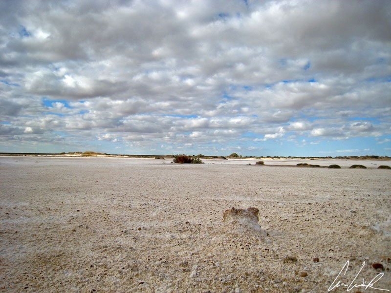
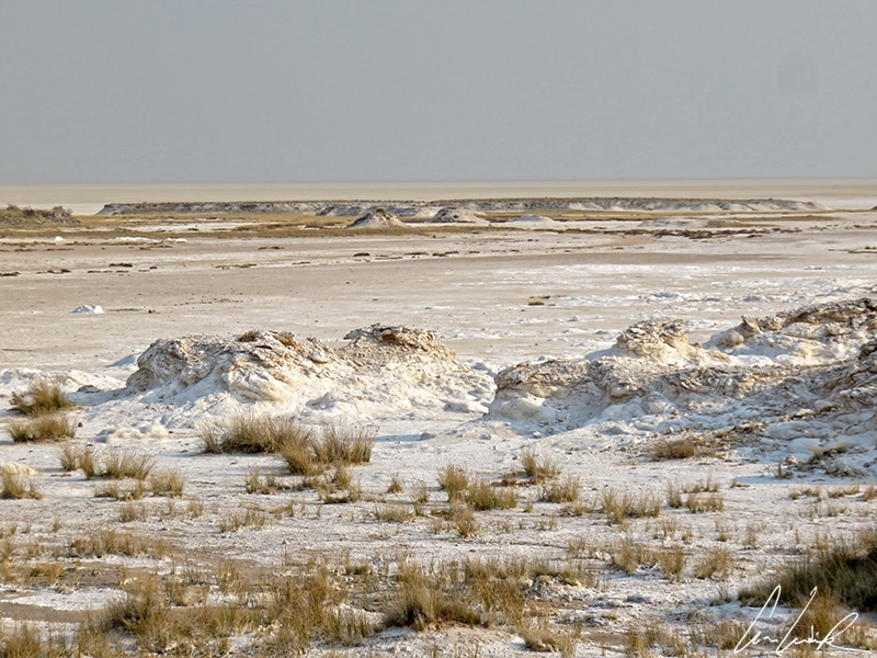
The Etosha Pan: a huge dry lake in the Etosha National Park
Covering about 1,840 mi2 and nearly a quarter of the Etosha National Park, the Etosha Pan is a large endorheic salt pan in the north of Namibia. Swedish explorer Charles Andersson and the Briton Francis Galton, accompanied by the members of the Owambo tribe, discovered the Etosha pan and the surrounding area in 1851. In the Owambo language, « Etosha » means « great white place ». During the rainy season, the pan fills with water, creating a lush oasis that attracts flamingos and crowned cranes. During the dry season, clay and salt mounds reflect the sun’s rays, creating mirages and surreal settings.
Desert of the Etosha Pan
The Great Salt Lake: the largest saltwater lake in North America
On a trip to the United States stop in Salt Lake City to discover the Great Salt Lake, also known as the « American Dead Sea ». It lies in the northern part of Utah and is a remnant of Lake Bonneville, a prehistoric lake that covered much of western Utah. With an average surface area of 1,700 mi2, this endorheic lake, which does not drain into any ocean, is the fourth largest saltwater lake in the world. With 42 mi2, Antelope Island is the largest of the ten islands located within the Great Salt Lake. The lake has a rich natural life, including pelicans, herons, cormorants, terns, and gulls.
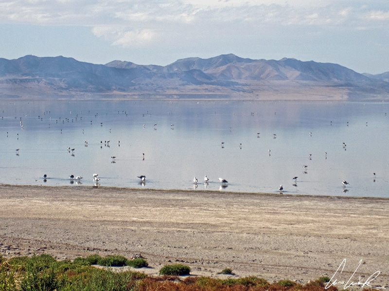
Desert of the Great Salt Lake
The Great Salt Lake lies at 4,206 feet above sea level in a harsh climate where temperatures range from -22 °F in winter to 108 °F in summer. The lake surface fluctuates greatly depending on the evaporation and the flow rate of the rivers flowing into it. It reached its greatest extent with a surface area of 3,300 mi2 in 1988 and then recorded a record low during the summer of 2021, beneath even the previous recorded low of 950 square miles in 1963. At the edge of the lake, a vast beach of white sand widens. It is the bed of the lake and should be covered with water, proof that the Great Salt Lake is gradually evaporating !
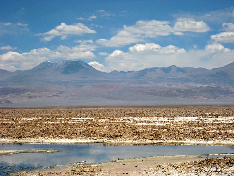
The Salar of Atacama: the largest salt lake in Chile
The Salar de Atacama is a vast salt area of 1,200 mi2. It is roughly 62 miles long and 50 miles wide and dominated by the silhouette of a volcano. The salt crusts form rough, petrified waves, and the thickness of the salt can reach 4,922 feet in some places. The Salar of Atacama creates a unique relief that takes on ochre, pink and beige hues under the effect of the sandy winds. The salar has magnificent lagoons like the lagoon Cejar or Tebenquinche, with salty, clear, turquoise, and emerald waters. These lagoons offer an unforgettable spectacle combined with the view of the volcanoes, the sky, and our own reflection in the seemingly bottomless blue water, or when a flock of pink flamingos enters these captivating and totally unreal surroundings.

Desert of the Salar of Atacama
Find more articles on the beauty of the mineral world of our planet !
- Coming soon